Torys’ PATHfinder map tool is designed to help IBA attendees make their way around conference locations using the PATH, Toronto’s underground walkway connecting the financial district.

This map connects IBA attendees to indoor PATH routes to and from*:
- IBA-affiliated hotels in Toronto’s financial district
- The Metro Toronto Convention Centre
- Torys LLP
FAQ
Use the icons in the top-left corner to select your starting point. A drop-down menu will appear: choose your destination from the list. Once selected, route details will appear: choose your destination from the list. Any outdoor portions will be indicated in red.
Once selected, route details will appear at the bottom of the screen.
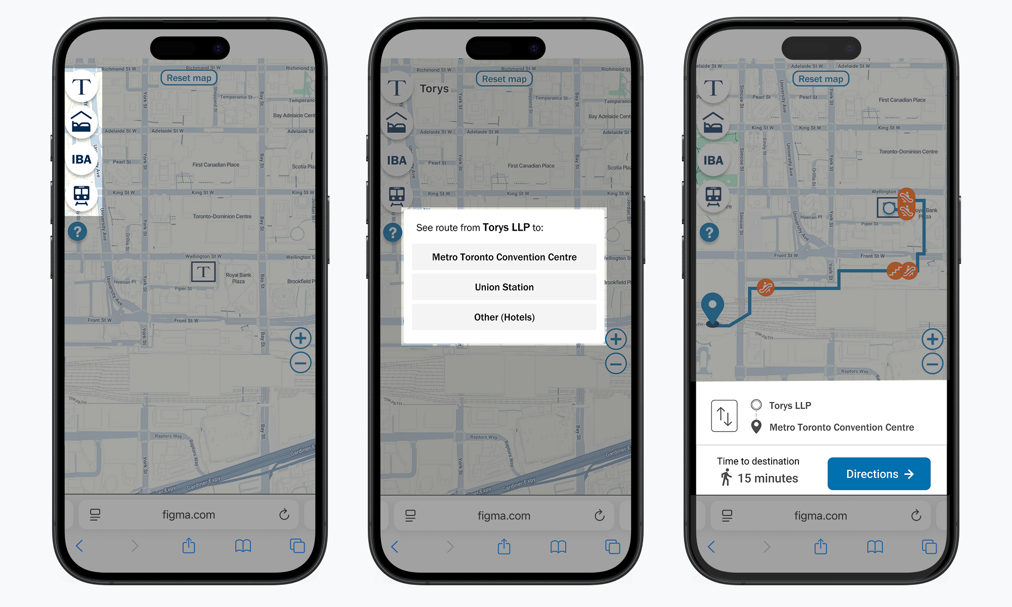
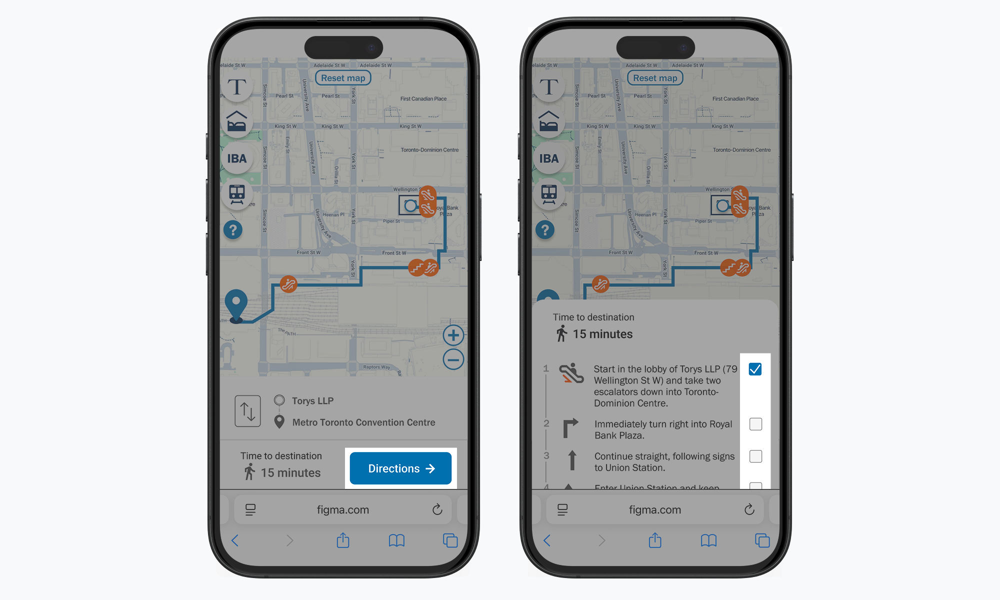
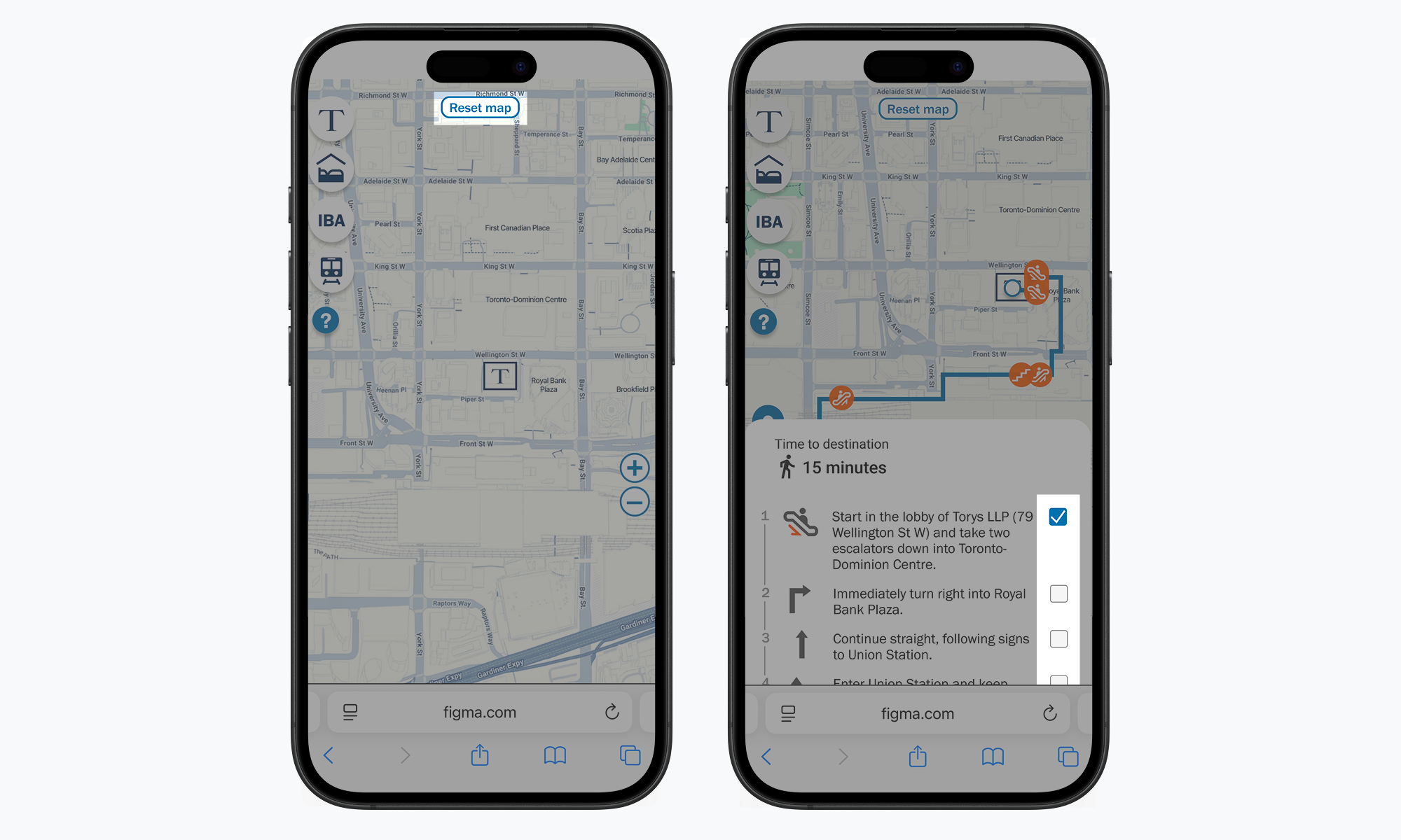
Tap the blue Directions button to view step-by-step directions. Use the checkboxes beside each step to track your progress.
Tap the Reset map button at the top of the screen to return to the starting page.
Torys’ PATHfinder map tool does not have GPS capabilities. The on-screen icon will not reflect your movement or progress. Use the checkboxes beside each step to track your progress.
*This map is not a comprehensive tool of Toronto’s entire PATH system. Rather, it is intended to provide quick and direct routes from IBA-affiliated hotels to specific locations.
**Accessibility disclaimer: Torys is committed to creating and maintaining an accessible office environment for all firm members, clients, and visitors. Due to the configuration of Toronto’s PATH system, not all routes shown in Torys’ PATHfinder map tool may be accessible. For questions or support, please contact pathfinder@torys.com.